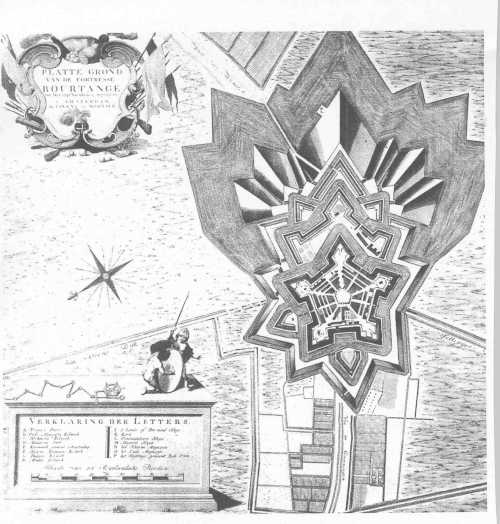
Map of Bourtange in the year 1742. source: https://nl.wikipedia.org/wiki/Bourtange
Bourtange is a fortress with a pentagonal shape, built at the end of the 16th century as part of the Eight Years war (1568-1648).
The fortress was built on a strategically important location, in the middle of the mashes blocking the only road which Groningen and the Spanish army used for transport. Willem van Oranje (Willem I of Orange) ordered to built the fort. In 1594 Groningen was reconquered and Bourtange became part of the northern defence line.
Until the middle of the 19th century the small fortress was a special kind of city in which soldiers, army and civilians lived together, and daily life was intertwined with military customs.
When the marshes started drying out and weapons became more developed and long range, the functionality of the fortress diminished.
In the 1960s the fort was deteriorating and it was decided to restore it to its 18th century state. Today, Bourtange is an open air museum.

)
)