Elburg, Netherlands, Europe
 
 
Year1396latitude: 52° 27'
longitude: 5° 49'
Period
Initiator(s)
Planning organization
Nationality initiator(s)Netherlands
Designer(s) / Architect(s)Arent Thoe Boecop
Design organization
Inhabitants12,000 (2020)
Target population
Town website
Town related links
Literature

type of New Town: > scale of autonomy
New-Town-in-Town
Satellite
New Town
Company Town
> client
Private Corporation
Public Corporation
> policy
Capital
Decentralization
Industrialization
Resettlement
Economic
 

Map of Elburg after 15th century
source: https://nl.wikipedia.org/ wiki/Elburg_%28stad%29#/m edia/Bestand:Oude_kaart_E lburg._Situatie_na_de_15d e_eeuw.jpg


Aerial image of Elburg between 1920-1940.
source: Nederlands Instituut voor Militaire Historie/Wikimedia Commons.


The Beekstraat in Elburg
source: RCE, https://nl.wikipedia.org/ wiki/Elburg_%28stad%29#/m edia/Bestand:Overzicht_-_ Elburg_-_20068853_-_RCE.j pg


Panorama of Elburg in the 17th century by Nicolaes van Geelkercken
source: https://nl.wikipedia.org/ wiki/Elburg_%28stad%29#/m edia/Bestand:Elburg_panor ama_1639-1655.png


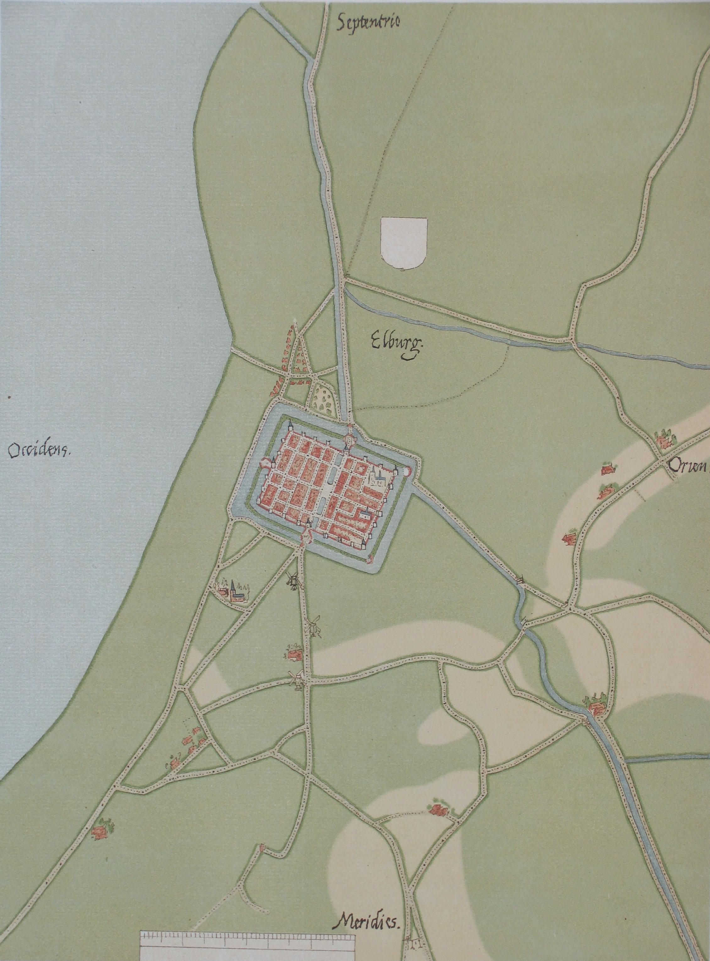
Map of Elburg by Jacob van Deventer
source: Jacob van Deventer_kaartenzaal UvA


Elburg used to be an important and wealthy trade city on the coast of the South Sea (now Flevopolder), part of the extensive, international Hanze-network in northern Europe.
In the 14th century this city was aligned along a coastal street, like many settlements of fishers and traders in the Netherlands at that time. Part of this elongated settlement was included in the new city that was designed and built from 1392-196 by rentmeester (local governor) Arent Thoe Boecop. He not only designed the rectangular city in a rational, mathematic way, but also made it into a fortress, with towers, walls, gates and surrounded by a canal. At the end of the 16th century the fortress was extended with a second line of defence.

source:

2008 - 2024 disclaimer