|
|
Tollebeek, Netherlands, Europe |
|
|
|
|
|
|
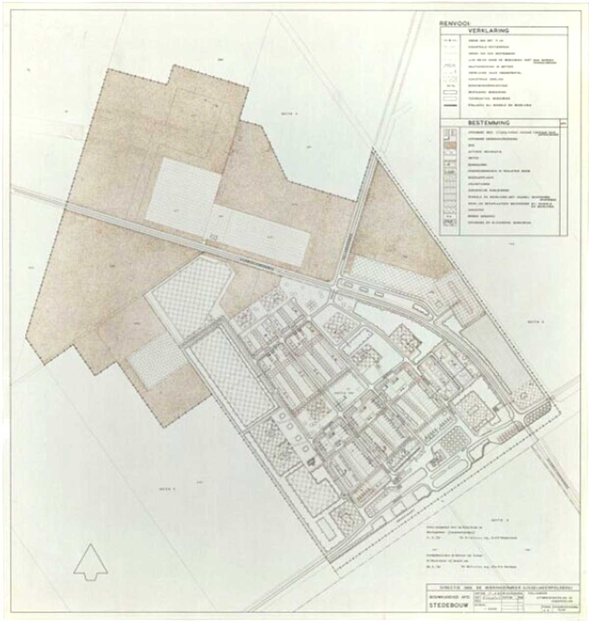
Uitbreidingsplan in
onderdelen, 17-04-1962
source: Directorate of the
Wieringermeer
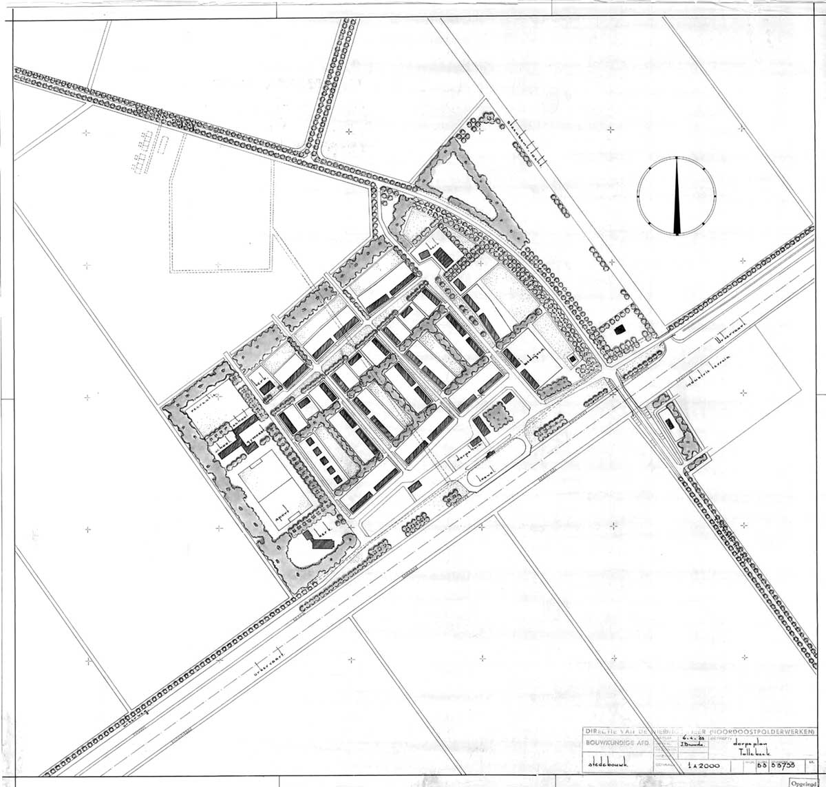
Situatie van het dorp,
01-09-1964
source: Directorate of the
Wieringermeer
|
Tollebeek is located in the Noordoostpolder, a polder that was reclaimed between 1937 and 1942 and previously belonged to the Zuiderzee. With over 30 kilometers of dike, an agricultural area of 460 km2 was added to the Dutch soil. The reclamation was a consequence of the Zuiderzee Act of 1918. Food supply had been elevated to a political priority after World War I and the economic crisis of the 1930s.
After the end of World War II, land was issued in 1947 to strictly selected farmers, mainly from the north of the country.
The design of the polder is based on the Central PLace Theory (1933) of German geographer Walter Christaller (1893-1969). He was the first to look at cities as a system in which smaller and larger cities form a network in relation to each other. He distinguished between A, B and C cities: small settlements, larger cities and regional centers.
Centrally located in the Noordoostpolder is the ‘capital’ Emmeloord, a city of the B-category. Around it, in a circle, are 10 villages of the A-category: Marknesse, Ens, Tollebeek, Luttelgeest, Nagele, Rutten, Creil, Kraggenburg, Espel and Bant. The later built Lelystad was a city of the C-category. The two islands of Schokland and Urk became part of the polder through reclamation.
Tollebeek is located between the towns of Urk and Emmeloord. In the south, the village is situated adjacent to the Urkervaart canal and on its North-Eastern frontier to the N713. It was the last village to be founded in de Noordoostpolder.
The village was initially designed with the majority of the houses enclosed by the road and the canal and with the public amenities on the periphery. These houses are mainly comprised out of low-rise terraced house with private gardens. Additionally, an expansion plan in 1960 proposed a recreational forest/park to the North of the village.
The village has the only remaining barrack in the Noordoostpolder that used to house the workers that worked on the land reclamation and construction of villages and towns throughout the polder. Having been used by the local football club and subsequently several local social clubs, with help of subsidies, the barrack has now been restored and houses the local darts club.
source: INTI |
|
2008 - 2024 disclaimer
|

)
)