|
|
Slootdorp, Netherlands, Europe |
|
|
|
|
|
|
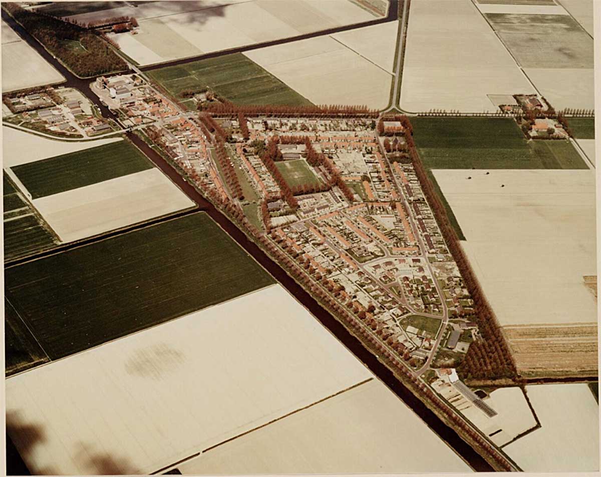
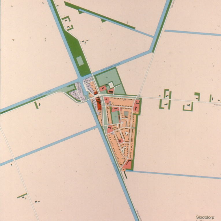
Slootdorp, 1975
source:
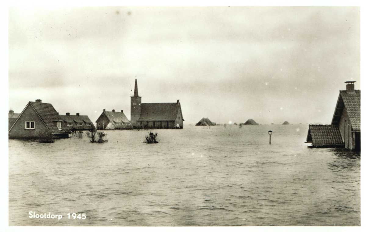
Slootdorp in 1945
source: www.wieringermeer.net/ans
ichtkaarten-1945-slootdor
p.html
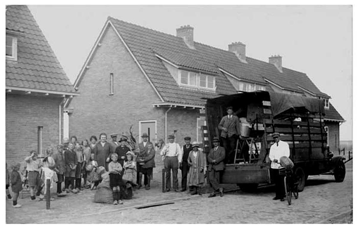
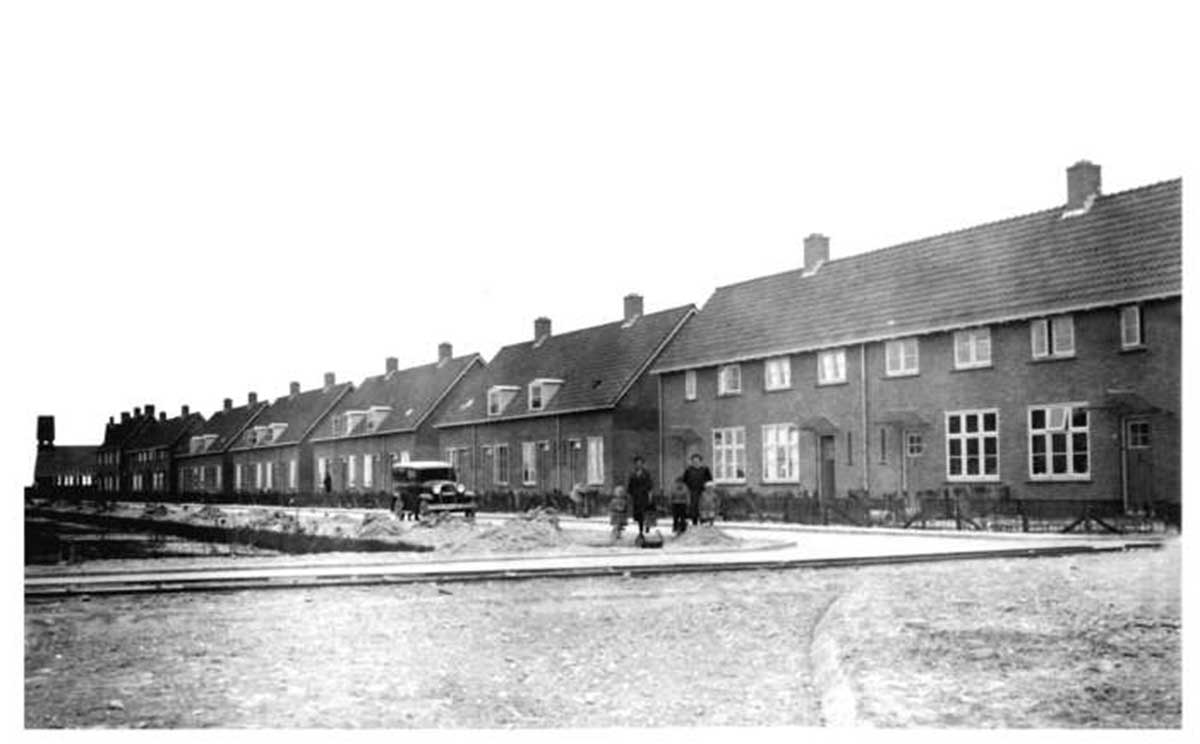
The first pioneers move
into their new houses,
1930s
source: homepage.theaveenstra.com
/Slootdorp.html
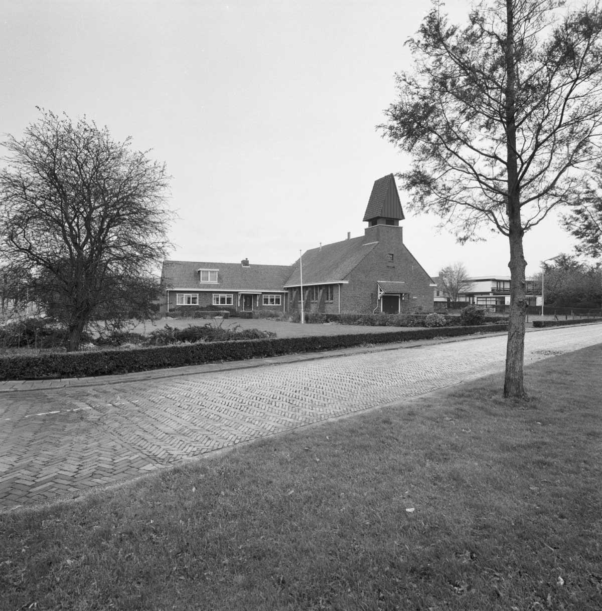
Reformed church by
architect G. van
Hoogevest, 1932
source: rijksmonumenten.nl/monume
nt/516094/nederlands-herv
ormde-kerk/slootdorp/
Houses along the
‘brink’, the village
green
source: www.wieringermeer.nl/cgi-
bin/beeldbank.pl?ident=00
39&search=VELD%20fromtype
%20Slootdorp&inword=2&dis
play=gallery&istart=1
|
Slootdorp is located in the Wieringermeer, a polder that was reclaimed in 1927-1930 as part of the Zuiderzee works according to the Zuiderzee Act of 1918. These works include the Afsluitdijk, designed by the famous politician and engineer Cornelis Lely (1854-1929).
The reclamation of the polder was done in a great hurry because of the fear of food shortage. Therefore, they did not even wait for the completion of the Afsluitdijk (1932) which made the work more difficult.
The planning of the polder was done by the government. Every new farmer was given 20 hectares of farming land in a lease system. Four nuclei were built, situated at intersections of roads and canals. First Slootdorp (1931), then Middenmeer (1932) and in 1935 the central core, Wieringerwerf. A final nucleus, Kreileroord, followed in 1956.
The settlements are very close together, within walking distance (max 5 km). Each village housed three churches for the various religious denominations and the corresponding three or four schools, as well as a small industrial area for agricultural industry.
The construction of the Wieringermeer was not undertaken as a purely technical project. In 1927 the renowned, traditional architect Granpré Molière was appointed as aesthetic consultant with the task of designing the settlements within the subdivision already made by the government department, while well-known landscape architects were also hired for the design of the roads, and the yard planting of the farms. The Wieringermeer was seen as an example for the later IJsselmeer polders.
Slootdorp is situated approximately four kilometers west of Wieringerwerf and equally four kilometers north of Middenmeer.
The building of the village commenced in 1930, becoming the oldest village in the polder. The design was made by the office of Granpré Molière, Verhagen en Kok, which also designed the other pre-war polder villages and it follows the same urban planning ideas. The principles are well described in the Heritage Inventory Wieringermeer:
“Based on a study of Dutch villages, the designer, the firm Granpré Molière, Verhagen and Kok firm, wanted to give the Wieringermeer villages a certain 'unboundedness outward' and a 'boundedness inward'. The result of this approach was 'the flowing out' of the village periphery into the land and the creation of a 'village green-like' space within the built-up area where the main through road had been traced. To achieve this, in Slootdorp the main road, which in the urban plan was laid along the canal, had to be bent inwards near the core. This meant that the ‘brink’ (village green), and therefore the stores, were eccentrically located in the plan. Two churches lie at the ends of the 'brink', while a third is situated on the east side of the village, so that the three buildings form the vertices of a triangle in which the sports field and gymnasium / community centre are located. In this way the spatial balance of the plan has been restored. A general characteristic of the Wieringermeer villages, (but also of most of the Noordoostpolder villages), is that the land behind the houses is generally large for the cultivation of vegetables for own use. Sometimes there are extra long backyards, sometimes there are so-called 'overtuinen' (gardens) separated from the backyard by a path.” Source: https://020apps.nl/mip/beschrijvingen/Wieringermeer.pdf, 1990
Despite its status as oldest village in the area, the architecture of Slootdorp (predominantly) dates from the reconstruction era after the war. Slootdorp had to be rebuilt after the destruction of some of the dykes by the Nazis left the majority of the polder flooded. Consequently, the majority of the housing architecture in the village had been constructed after 1945. Since then, the village has not changed a lot, with only a slight expansion northward in the early 2000s and a simultaneous regeneration project of houses closer to the city centre.
source: INTI |
|
2008 - 2024 disclaimer
|

)
)
)
)
)