|
|
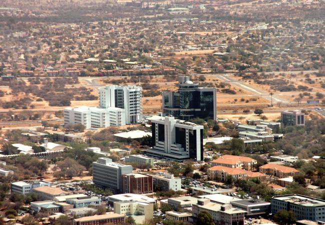
Gaborone, Botswana, Africa |
|
|
|
|
|
|
source: http://www.botswanatouris
m.co.bw/destination/gabor
one
source: http://www.africapoint.co
m/flights/botswana/gaboro
ne/gaborone-gbe-to-nairob
i-nbo.html
|
Overview
It was this modest site that was chosen in 1964, just before independence, as a capital city for newly-independent Botswana. Enthusiastic town planners set about building an entirely new settlement and the administrative centre was moved from Mafikeng. The town planners created a new parliament, government buildings and Africa's first traffic-free shopping mall where pedestrians could wander and shop, safe from the traffic, under the shade of the original trees. Most of the capital was constructed in just three years, which required a huge labour force from rural areas, and many builders remained in the capital after construction was complete, creating informal settlements in peri-urban areas.
Since 1966 Gaborone was the capital, and two decades later, in 1986, it was declared a city. Today, stimulated by the discovery of diamonds and the rising wealth of the nation, Gaborone has become one of the fastest-growing cities in the world, while still preserving its offbeat rural charm.
Urban Fabric
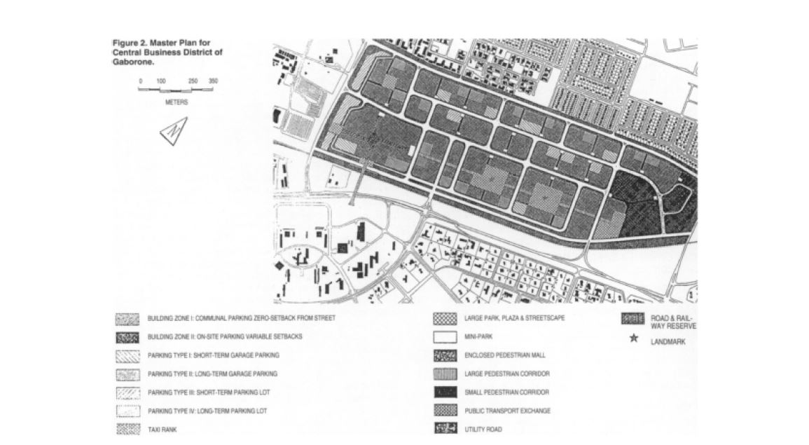
Gaborone, which was well-situated along the Notwane River and free of complicating tribal affiliations, was planned based on Garden City principles. It intended to be a walkable, green city with verdant public spaces and was originally planned for just 20,000 residents. Gaborone's concentric semi-circle layout forms 15 wards, each of which has a designated function, as represented in bright Botswanan colours, well-ordered districts, wide boulevards and parkland. The spatial structure likens to a “brandy glass”, with the stem containing the ‘Mall’ or central boulevard of government offices. CBD (Central Business District) has a mixed-use function and consists of the tall buildings housing government buildings, Industrial Court, retail space, and office space. Main malls of the city are surrounded by smaller buildings. The outskirts of the city feature the airport, golf club, fairgrounds, the national stadium, and the university, plus other facilities.
According to the greater plan of Gaborone (1994-2011), commercial areas plot size range 5000-5400 square meters; industrial areas plot size – 20000 square meters, areas for smaller individual activities – 800-500 square meters, open spaces – 6 square meters per household.
Infrastructure
Gaborone's modern infrastructure includes water, electricity, roads and sewage systems. Virtually all people have access to land: both the public and the private sectors provide adequate housing, and for the low-income class, a very successful program of squatter upgrading and self-help housing works. At the same time, the city experiences limited access to public transports and cycle routes, increased car ownership as well as high risk of pollution and congestion.
source: http://www.discover-botswana.com/articles/gaborone.php
https://www.pahor.de/maps-and-prints/africa/botswana-gaborone-urbanism-gaborone-town-plan.html
http://www.6under60.com/gabarone/ |
|
2008 - 2024 disclaimer
|

)
)