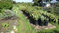
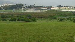
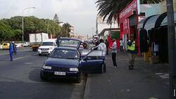
Imagine a complete and mixed neighbourhood that facilitates social integration and co-existence as an inclusive model for Cape Town’s urban development, all while encouraging density at a scale that strengthens connections between people and their city. Just outside of Cape Town’s central city area, located on Voortrekker Road, the suburb of Maitland has the potential to grow into just that: a place where density brings more people and cultures together in affordable, inclusive, and economically-advantageous ways. As a “Pan-African Hub”, Maitland’s current affordability and central location already draw South Africans, immigrants, workers, developers, students and middle-class families of all ethnicities to the area, creating a diverse group of residents, visitors and businesses in the neighbourhood. And, as Cape Town’s population continues to grow, this area is becoming increasingly more desirable for more people, creating the need to plan for an inclusive and resilient future for the suburb if it is to keep the same characteristics that make it so desirable today.
The current challenge is to develop a strategy that secures and intensifies these qualities and steers a collective and incremental development process to explore what people want and need from Maitland as a residential, educational and commercial space. With a better idea of what a more densified Maitland could be, we can help ensure that population growth in the area leads to expanded business opportunities, a better supply of affordable homes, and a more diverse strategy of land and building use, particularly for temporary and seasonal purposes like churches, markets and student homes.
A vital mix
Economically and spatially speaking, Maitland is well-connected to the rest of the metro-region: The Voortrekker Road corridor forms the spine of the area and connects its historic and growing economic activity to Cape Town’s Central Business District and Bellville. As a whole, the Voortrekker Road Corridor currently provides around 50 % of Cape Town’s jobs [1], showing just how key this economic connection is for Maitland in terms of jobs and business. People in Maitland also have strong access to these opportunities through public transport like local trains, busses, and minibus taxis, bringing thousands of workers in from the larger metro-region each day. The Maitland section of the Voortrekker Road Corridor supports a vital mix of industrial, commercial and business activity along with a growing number of businesses run by migrants from all over Africa — opportunities that support a stronger level of economic growth in close proximity for Maitland’s residents. This area is well integrated and in close proximity to calmer housing areas through an urban grid that promotes strong connections between people and opportunity — a characteristic that Maitland shares with other places along Voortrekker Road. This connectivity helps to support a diverse array of affordable housing typologies in the neighbourhood: single-family homes, multi-family apartment blocks and government-driven social housing initiatives. They all integrate with one another amidst diverse public spaces and facilities and cater multiple income brackets and affordability categories. Established before Apartheid, Maitland allocates many listed industrial buildings and houses which complement the richness of the neighbourhood.
Build on what already works
When looking at how to promote greater levels of densification in the area, our goal is to build on what already works and make it more accessible for more people. Our strategy introduces a density framework – a set of urban enhancement principles – to build on the affordable housing opportunities, job possibilities, and integrated characteristics of the area. We developed this framework in a way that doesn’t use these characteristics as a springboard to higher income brackets, but instead uses them as principles to keep the area affordable for those who currently live here and new residents, too. The framework envisions a range of pilot projects that can catalyse a development process to ultimately lead to Maitland’s consolidation as a “Pan-Africa Hub”. We promote the use of mixed-use design and higher-density housing as means to intensify the use of buildings, public spaces, transport and public infrastructure and to facilitate social and economic interaction. These all serve as tools in strategies that are based on new suggested policies and business incentives that facilitate a mix of public and private investments of various scales. Importantly, these policies and incentives also introduce a range of low-cost housing typologies that promote flexibility in design to cater for a wider market of users.
Pilot projects on strategic sites
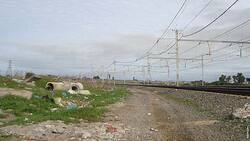
By working to enhance and expand accessible and affordable densification in Maitland, we also aim to set an example for possibilities in other areas of Cape Town in a way that helps reverse some of the deep inequalities in the city’s urban fabric. Today, twenty years after the end of the Apartheid, roughly 90% of the city [2] is still largely dominated by a city structure that deliberately reduced interaction between different ethnicities and social classes to a minimum through urban planning and social engineering. In this context, our strategy introduces an integrated approach to densification in an urban area already built, in a way that can be applied to locations beyond Maitland. Our proposed pilot projects are located on strategic sites that represent typical situations in Cape Town, particularly along Voortrekker Road: leftover spaces along transport infrastructure, over-dimensioned school yards, low densities on well accessible spots, fragmented public spaces around train stations and other scenarios are some of the characteristics that we have focused on. By testing new strategies on different kinds of urban infill sites, we have developed the framework as a tool to be used in order to induce a gradual transformation of Apartheid’s urban heritage into a more inclusive urban environment through sustainable, affordable, and integrative densification.
Participants
– NL Architects
– Uberbau
– Matthew Gray Architects
– City of Cape Town Urban Planning Department
– Cape Town Partnership
– Greater Tygerberg Partnership
– Design Space Africa
– University of Cape Town
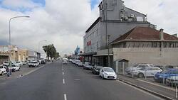
photo: Pieter Bannenberg
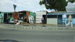
photo: Michelle Provoost
Maitland (photo: Ali Saad)
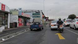
photo: Pieter Bannenberg
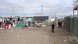
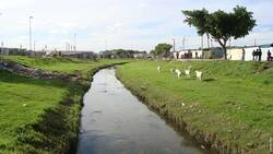
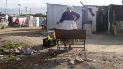
Lotus Park is a small informal settlement in Gugulethu strategically situated adjacent to the Nyanga train station on the embankment of the canalised Lotus River. Unlike most informal settlements, Lotus Park is well structured both spatially and socially. The fine grained urban fabric comprised of single story shacks facilitates pedestrian movement and displays an intricacy of nuances in public and private thresholds and appropriation of space. With unemployment at 50%, and a huge percentage of the community being children under 18 years, Lotus Park has to deal with the harsh social, economic and spatial injustices of the Apartheid era. Given the chance however, this vibrant community will embrace the opportunity to make Lotus Park their home.
Retain density and reconfigure the urban fabric
The Violence Prevention through Urban Upgrading Programme has been working with the community structures since 2010 to develop a participatory upgrading model that takes cognisance of the current residents needs and improves holistically the quality of life of residents in the area. Personal safety, security of tenure, resilience, the provision of public infrastructure, capacitation of leaders and residents and a continuous monitoring of the development are elements that the programme entails.
The Density Syndicate investigates within this process how density can contribute to the social and economic empowerment of the Lotus Park community. In comparison to other urban agglomerations, Lotus Park has a relatively high density of 220 du/ha. The goal of our group is to retain the density and to reconfigure the urban fabric by introducing housing typologies which facilitate incremental growth. This goal required us to consider three main elements:
–
1) The household and cluster level
–
2) the urban scale, and -
–
3) the financial and procedural arrangements.
By bringing these elements together, we believe that the ideas presented might hold options for a model for developing informal settlements.
Effective use of collective infrastructures
By addressing this reconfiguration on the cluster scale, the benefits of both collective financing and participation planning can be maximised. Besides the social economic advantages of renegotiating space on the cluster scale, this approach makes it possible to maximise the effective use of collective infrastructures. The notion of collective infrastructures (such as wet cores on the cluster scale) can potentially be extrapolated on the neighbourhood scale in the form of a biogas installation and productive wetlands along the Lotus River. Collective infrastructures represent an economic opportunity through reduced operational costs and potential income generation after initial investments have been regained.
Stimulate local economy
Within this framework, the renegotiation of the density of the territory and incremental development of new housing clusters represents an incredible opportunity to stimulate the local economy and facilitate empowerment. This will only succeed when combined with a long term structural support and organisational forms to manage and facilitate the process which includes a complex tenure arrangement required to ensure that people have the rights and abilities to live and improve on their homes; financial arrangements that need to be developed around the cluster and structural transformation of the settlement on a neighbourhood scale.
Participants
– Doepel Strijkers
– Land+Civilization Compositions
– Jakupa architects
– Violence Prevention through Urban Upgrading (VPUU)
– Community Organisation Resource Centre (CORC)
– City of Cape Town Urban Planning Department
– University of Cape Town
– John Spiropoulos strategies and solutions


