
Dimitrovgrad, established on the grounds of three villages with rich historical background—Rakovski, Mariyno, and Chernokonevo—traces its roots back to ancient times, with archaeological evidence revealing human habitation for thousands of years. The region’s fertile soil along the Maritsa and Merichlerska rivers attracted inhabitants since antiquity. The largest village, Rakovski, witnessed significant development, particularly with the completion of the Baronhirshovata railway in 1873. The late 19th and early 20th centuries saw the rise of coal mining and the establishment of power plants, transforming the region into a major industrial centre.

Dimitrovgrad as a town was established in 1947, when the new communist government decided to unite the already developed smaller villages. The region has already emerged as a new industrial hub with the establishment of a cement plant, fertiliser factory, and a power plant. Dimitrovgrad was named after Bulgaria’s first leader of the Communist Party - Georgi Dimitrov. Construction started in 1947 and in the following years, over 50,000 volunteers from the “brigades movement” travelled to Dimitrovgrad to contribute to its development. This movement, composed of thousands of young volunteers, transformed the town into a propaganda showcase, symbolising the transition from rural to urban society.
The city was built according to the design of architect Petar Tashev, whose plan embodied socialist realism ideals. Tashev’s plan, although visually aligned with socialist realism, subtly incorporated modernist town planning principles, including functional zoning and free-standing buildings within lush green spaces. Today, Dimitrovgrad stands out as perhaps the only continuous garden city in Bulgaria, with parks interconnecting residential blocks.
In recent years, the municipality has actively promoted Dimitrovgrad as a unique cultural heritage, achieving recognition through campaigns, conferences, and national declarations. In 2010, three sites in Dimitrovgrad received recognition as cultural heritage of national significance, marking the first declaration and protection of socialist-era architectural ensembles in Bulgar.
Representative Organisation:
Municipality of Dimitrovgrad
New Architectural Heritage Foundation
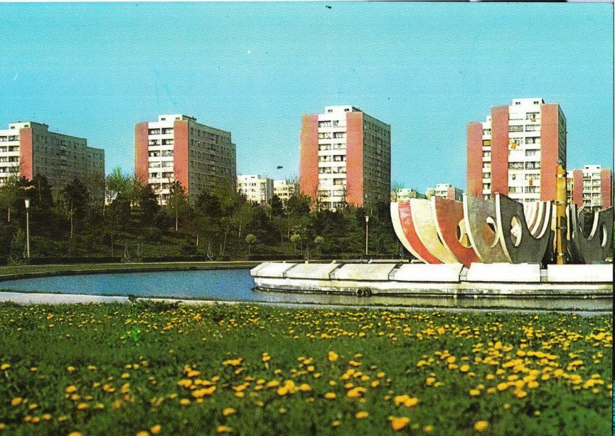
Drumul Taberei district is one of the most remarkable materializations of the “socialist city” in Romania. It was built starting with the 1950s as a satellite-city in the outskirts where it used to be an empty field, as many of the early dwellers recall. Designed by a team of young architects, inspired by the modernist paradigm, an initial master plan articulated several micro-rayons along a loop boulevard. Centralised planning, apartments’ standardisation, construction prefabrication and unlimited access to resources, such as public land, amounted to a generous proposition for collective living. It even became a protocol district for the socialist authorities who brought here visiting heads of state here and it became a sanctuary for political refugees from abroad.

Less dependent on a major industrial platform, combined with its lavish green spaces, with its planned educational and civic infrastructure, sport facilities and public transport, Drumul Taberei became a sought-after destination also for other professionals than factory workers, like clerks, teachers, doctors and engineers. Benefiting from a high rate of ownership from the start, dwellers started “bringing each other” into the neighbourhood, creating family- and vicinity-based networks. In time, these relations proved to be more resilient against the fragmentation and disengagement specific to other districts.
However, the planned public grid was never fully completed. The district has always been an unfinished place, thus fertile for ad-hoc adaptations, such as community gardening. After 1989, the state retreat, the massive privatisation and the public infrastructure decay characterised the post-socialist city. Informal practices, developed during late socialism, came in full light and took over the in-between spaces, such as the gardening in between the blocs. Nevertheless, since the 2000s such practices were progressively dismissed by the dominant “civilization” discourse as remains of the “communist past”, being discouraged, forbidden and even evicted by the local administrations. As the more collective practice diminished, gardening became a rather individual and discrete practice, but always ready to bloom again, as it happened during the recent pandemic.
Representative Organisation:
studio BASAR
University of Agronomic Sciences and Veterinary Medicine in Bucharest

Dunaújváros is situated in the heart of Hungary on the West side of the river Danube, about 70 kms south of Budapest. The town can be reached from Budapest via the M6 Freeway or the #6 Main Road, from Székesfehérvár via the #62 Main Road. At about 150 m above sea level the town is bordered by the Danube on the East for about 10 kms, and by some slight hills on the West. In the summer of 2007 a new bridge over the Danube was opened in the city. The area was inhabited at a very early age even in the prehistoric times. Objects were found from the prehistoric period and from the Bronze Age as well. A significant amount of findings were excavated from Roman times, when a Roman military camp named Intercisa and the connecting civil town played a significant/important role in the protection of the Roman Limes (borderline). The settling Huns and Magyars arrived in the area at the beginning of the 10th Century. Pentele – the base town was probably in existence in the Árpád-age being named after the middle-age Greek saint – St Pantaleon.

This small base town was overrun by the industrial town being erected in the middle of the 20th Century. In 1950, as the main development project in Hungary, the construction of the new city named Sztalinvaros (Stalingrad) began. The town and industrial complex originally designed for 40 000 residents was the result of the heavy industrialisation of the 1950’s, the typical showcase of Social-realistic construction style and the utopist imagination of the political regime of the time. It is by far the most significant memorial of Social-realistic architecture. As a result of the consolidation period following the 1956 revolution in Hungary the name of the town was changed to Dunaújváros. The name of the steelworks was changed from Stalin Ironworks to Dunai Vasmű, and later to Dunaferr Rt,. From 2023 it continued to operate under a new owner, Liberty Dunaújváros. The Ironworks is still the most important industrial company in Hungary and plays a significant role in making Dunaújváros the centre of the region. Dunaújváros is the largest planned city in Hungary. The construction of the city can be divided into three distinct periods: initially, from 1950, the model city of socialism produced modern, aesthetically outstanding, liveable buildings and public square. Then, with the population explosion of the 1970s, the city was expanded with one of the most densely populated prefabricated housing estates in Europe. After the change of regime, it was supplemented with a narrow area of detached houses, where better-off families settled, moving out of the city centre.
Representative Organisation:
Institute of Contemporary Art of Dunaujvaros
(Grand Paris Sud)

In 1965, Évry changed from a small village to become a city, when it became part of the French New Town initiative. Évry was developed faster than other New Towns at the time. In 1968 there were already 155,000 residents in the region and this rose to over 200,000 by 1972. This rapid expansion threatened the soil and water table. Planners planted large woodlands in order to protect the local ecosystem and viability of the town. Évry is a centre for a wide range of commerce and services. Located in both the Seine-et-Marne and Essonne départements, Sénart was the last of the new towns to be developed under President Charles de Gaulle’s 1967 government plan. Its Établissement Public d’Aménagement (E.P.A.) was set up in 1973, but it really took off in the 1980s.

The new town of Senart is composed of ten communes: Cesson, Combs-la-Ville, Lieusaint, Moissy-Cramayel, Nandy, Réau, Savigny-le-Temple, Vert-Saint-Denis, Tigery and Saint-Pierre-du-Perray. In 2016, Evry and Sénart became part of Grand Paris Sud (GPS), an urban agglomeration which merged 23 municipalities Today, the agglomeration is home to more than 350,000 inhabitants. The two new towns have very different characteristics and issues: Evry is more urban with a dense urban centre – the challenge here is linked to the renovation of the urban core and the attractivity, while Sénart is more “city in nature” and GPS is developing a strategy to better consider its green assets.
The territory of the agglomeration Gran Paris Sud is highly diverse, with many economic and social contrasts. There are 19 priority neighbourhoods in the agglomeration of Gran Paris Sud with low-income populations. They are covered by the national “city policy” program for the reduction of inequalities and urban renewal. Many of the inhabitants of these neighbourhoods have a migrant background. The agglomeration is implementing programs for social and professional inclusion. One of them is the inter-communal linguistic coordination, to accompany the public towards social and professional integration through French language learning. A tool called AVEC was created to fight illiteracy and to improve access to French language for migrant allophones, regardless of being newcomers, with little or no qualifications and job seekers. Next to that, the program AVEC Elles deals with the integration of vulnerable women in the labour market.
Grand Paris Sud is working on different strategies to make its territory more sustainable and to ensure the just and inclusive ecological transition for its inhabitants: development of Eco-neighborhoods, development of heating networks, raising awareness among residents (positive energy families, composters, etc.), reuse of brownfield sites, reuse of soil, reuse of materials, bicycle plan and active transport links, reflection on food and urban agriculture.

In 1883, Chemnitz became a city with over 100,000 residents, and just 30 years later this figure had risen to 320,000. However, the city was subject to heavy allied bombing during World War II, destroying key industries in oil and 6 automobile manufacturing. Post-war, modest low rise housing was constructed in the now Soviet occupied East Germany. In 1952, the GDR established the city of Karl-Marx-Stad as an idealist socialist city. Modern Plattenbau buildings were prioritised over the preservation of older historic ones, resulting in many of them falling into disrepair and even dereliction. The town continued to be a prominent player in machine construction up until the 1990’s.

In 1990 the town was renamed Cheminitz and a re-planning of the city was ordered while East Germany suffered from mass migration to the west. Shopping facilities on its peripheries were constructed to compete with West German cities. Hundreds of partially historic buildings were levelled to facilitate the revamp. Now, much of the centre has been restored and its 244,000 residents eagerly await becoming European Capital of Culture 2025 (ECOC). The Fritz Heckert residential area, named after the politician of the German Communist Party of Chemnitz Fritz Heckert, is a prefabricated housing estate in Chemnitz, It was the third largest, and at times the second largest, new housing estate in the GDR.
From 1974 onwards, flats were built in large panel construction in the districts of Helbersdorf, Markersdorf and Kappel, where almost 90,000 people lived in 1990. After reunification, prefabricated housing estates quickly lost their appeal throughout the former GDR and many residents moved out. A high vacancy rate was the result, so that in 1998 the demolition and remodelling began. Entire rows of houses disappeared, to make way for small detached houses. In addition, some of the higher building units were shortened to fewer storeys. In 2004, just over 43,000 Chemnitz residents still lived in the “Heckert”. The remaining substance has been and is being renovated to improve the quality of living.
Representative Organisation:
Chemnitz 2025
Institut für Ostmoderne

Hellersdorf used to be a small village in the vicinity of Berlin, until in 1985 constructions of a new large housing estate in prefabricated slab construction began on the area of former sewage fields. The district is located in the northeast of the Marzahn-Hellersdorf district and thus on Berlin’s eastern border with Brandenburg. It was the latest and one of the biggest New Towns in the former GDR. The subway connection to the city centre went into operation in 1989. As Berlin’s second largest construction project, the Helle Mitte district centre was completed and ceremoniously opened in 1997.

Hellersdorf has been a Berlin district in the Marzahn-Hellersdorf borough since the 2001 administrative reform. Approximately 90,000 people live in the Hellersdorf district alone, but the cultural and also social infrastructure is far from adequate for such a medium-sized city. Thus, the station urbane künste/nGbK Hellersdorf, founded in 2014, is one of the few places for urban debates and contemporary arts. It sees the peripheral nature of Hellersdorf as one of its key characteristics, which it shares with other New Towns and satellite cities. At the same time Hellersdorf is also a vital place in which it will be possible to develop other forms of support structures, to implement long term projects, and not just in the centre of Berlin. The city is victim to a socio spatial disintegration. Hellersdorf needs to find the strength and power to find a cosmopolitan perspective of the common good. The biggest challenge is to find new ways to understand each other, to deal with conflicts and to negotiate them in the very diverse situations that a 21st century city increasingly offers.
Representative Organisation:
station urbaner kulturen/nGbK

Nestled on the outskirts of Sarajevo, Ilijaš has experienced multiple stages in its development. In the 19th century large industrial developments (Sawmill) were built, in 1939 a worker’s settlement was realised and in 1952 the largest development started with the establishment of the industrial complex (Ironworks). This final development was instigated by a series of People’s Committees. Ilijaš boasts a layered heritage from mediaeval to industrial times, intertwined with nature and socialist housing.

As time trickles by, Ilijaš is becoming a suburb of the ever-expanding Capital, Sarajevo. The New Town now celebrates its industrial past and vast green spaces which are integrated into each community. The low-density municipality (50-60 residents per square km) has 55% forest cover. The town of 20,000 people hopes to build its legacy of ecology through tourism. Sustainable urbanism is one of the priorities listed in the Municipal Development plan for the period 2021-2027 and focuses on reconstructing the towns infrastructure along with improving the riverbanks, quality of processed wastewater and most importantly regenerating the largest Brownfield zone, the Ilijaš Steel Mills.
Representative Organisation:
Municipality Ilijas
NK ICOMOS

Kohtla-Järve is the fifth-largest city in Estonia. The northern part of Estonia is rich in oil shale and for this reason a settlement was erected here already before World War II, which grew exponentially into a city in the immediate postwar years when Estonia became part of the USSR. In 1949 a power plant was built, fuelled by oil shale. Kohlta-Järve consists of different urban cores built in the 1950s and 1960s, each highly industrialised.

The city is very diverse ethnically: it contains people of over 40 ethnic groups. Only 21% of the population are ethnic Estonians; the largest group (73,6%) is Russian. Many people have very close ties to Russia. Not all residents of the city speak Estonian well. There is a large number of stateless Russian-speaking population. Sometimes it seems that the whole region of the north-east of Estonia (including Kohtla-Järve) is in a different information space than the whole of Estonia. The city wants to become an integrated, multicultural community that is connected to Estonian society.
Sustainable urbanism is perhaps the greatest challenge for Kohtla-Järve, since the oil shale industry is the basis for life and economy in the city, but this will need to change as it accounts for 50% of the CO2 emissions of Estonia. This asks for huge transformations in industry, education and public services.

Milton Keynes, like many new towns and cities, is at a crossroads in its short but important history. Renowned and studied internationally for its ‘grid and green’ masterplan, this design is now, at the same time, recognised for its significant heritage and new city future application. This project will help highlight how this in-built design for green spaces, wildlife and biodiversity must be safeguarded and should actively be used to meet the green challenges of the future.
In June 2022, Milton Keynes became one of eight cities to attain City Status from Her Late Majesty Queen Elizabeth II as part of Her Platinum Jubilee celebrations. This has provided an opportunity to review and refresh plans and policies for this ‘New City’ status including development of a refreshed Cultural and Creative Strategy and development of a new Tourism Strategy for Spring 2024.

On September 15, 1947, a new state border sliced through the centuries-unified Goriška region, disrupting families, fields, houses, economic buildings, courtyards, and streets. The territory had been part of the Habsburg monarchy since 1500, and following World War I, it became a war spoil of Italy. After World War II, the new border division left the region capital Gorizia and its more urbanised area in Italy, while Yugoslavia received the predominantly agrarian and ethnically Slovenian hinterland. Instead of expanding an existing nearby location, Belgrade decided to build an entirely new city. Intent on turning defeat into victory, they planned to construct a “new” Gorica as a symbol of triumph. This city was the first newly planned city in the new Yugoslavia, intended not just for industrial purposes but as a new administrative, educational, and cultural centre, expected to house 10,000 people within five years.

The urban plan was designed by Edvard Ravnikar, a prominent architect influenced by Le Corbusier’s modernist planning, featuring large buildings, long avenues of trees, and spacious green areas. The city’s construction was an ideological project, with youth brigades from across Yugoslavia participating in a show of brotherhood and unity. However, after the Soviet Union expelled Yugoslavia from the Eastern Bloc in 1948, the ideological need for a city that would shine beyond the border was thus gone, and so were the financial inflows from the capital. The development of the city thus soon fell on the shoulders of the local authorities, who did not share the enthusiasm for such an ambitious city plan. Financial constraints led to adaptations of Ravnikar’s original plan, making the city more “human-sized” and avoiding many issues of modernist cities.
With the shift of the Iron Curtain to the eastern border of Yugoslavia, the border was no longer an obstacle, but an opportunity. Rather than a socialist showcase to the west, it became a capitalist entry point to the east. The inhabitants could simply walk to the other side of Europe’s most open border between East and West to get the latest novelties. Among other things, the first pedestrian zone in Yugoslavia was built in the city, inspired by the Lijnbaan, the first ever European pedestrian zone in Rotterdam.
On the other hand, the city wanted to attract tourists from the West. This culminated in the idea of a casino. In 1984, the first Las Vegas-style casino was opened, which was the start of the city’s transformation into one of the most popular gambling destinations. In 1988, it became the largest Yugoslav gambling centre. In 1994, Casino Perla became the largest casino in Europe in terms of the number of gaming tables, which consolidated Nova Gorica on the European gaming map.
In 2004, Slovenia joined the European Union along with nine other countries. The then President of the EU Commission, Romano Prodi, celebrated the accession of ten countries from Central and Eastern Europe in the square in front of the railway station, which is also the common square between the two Gorizia cities. Today, 20 years later, both towns are preparing for becoming the first transborder European Capital of Culture in 2025. 14.000 people now call Nova Gorica home. However, the whole transborder conurbation has around 80.000 inhabitants.
The history of Nova Gorica is a history of constant shifts and changes of ideas. This means that planned towns can also be unplanned. The city needs to discover its identity, which is the main idea behind the project Ab Initio - an urban utopia (part of the ECoC official programme). This means rediscovering the modernist heritage of the city through the analysis of literature and in-depth interviews with locals who built and designed the city. To listen to the voices of the locals and to incorporate their experiences, thoughts, ideas, and wishes into cultural development, various discussions and debates need to be held with different target groups (old people, young people, economists, former workers, etc.). In this way, the local people will become important participants in the construction of the city culture and interpreters of its local heritage, with much potential for straightening the urban community, identity, and well-being.
Representative Organisation:
Association of Humanists from Goriška region

In 1949 construction of Nowa Huta began in typical Soviet realist-stalinist fashion. Nowa Huta was to be an idealist socialist city, similar to Dunaújváros, with a radial layout based around a central square. The city’s steel plant was at the epicentre of the town’s development plans. In its heyday the plant employed 40,000 workers, producing 7 million tonnes of steel. The core was designed within a semicircular shape with a central pentagonal square on the south side, where the five directions of Nova Huta’s streets meet. Each district was intended for 20,000 inhabitants, divided into neighbourhoods of 2-5,000 inhabitants. Initially buildings were built traditionally, but in 1954 prefabrication was introduced.

The 1950 masterplan allowed for a population of 100,000. In 1978 the population was 278,000. Housing supply failed to meet demand and many people were placed in worker’s hotels. Despite many buildings being of poor quality, the housing crisis did not permit reconstruction. Today Nowa Huta is less reliant on the steel mill, instead it is transforming itself through tourism and housing renovations. However, these new trajectories are not without controversy. New housing estates are not inclusive or affordable and have an effect on the old estates. Since the industrial plants are ending their operation, nature is taking over in post-industrial areas. The challenge of environmental pollution and its impact on local residents remains. Nowa Huta has an interesting and in some aspects heroic history, but the stories of the inhabitants have been insufficiently collected in the oral archives. Presently, there’s an influx of newcomers (e.g. war refugees), but who are they? Little knowledge exists on these new groups of inhabitants and how they can feel at home in Nowa Huta.
Representative Organisation:
The Norwid Culture Center

San Polo is a neighbourhood of around 19,000 inhabitants in Brescia in northern Italy, and represents a unique example in Italy of a neighbourhood built through public initiative. The construction of the neighbourhood is a radical operation that overturns the ordinary logic of Italian planning and urbanisation. Typically, in Italy, where land is private, the change of land use from “agricultural” to “buildable” originates from a modification to the master plan. The new plan suddenly and significantly increases the value of the land – its “land rent” – benefiting the private owner and allowing for extensive speculation.

To avoid speculation, San Polo adopts a different method. The municipal administration acquires a sufficiently large portion of land to build a neighbourhood that satisfies the entire housing demand and initiates a market for public buildable areas. The price is determined, based on the total expenses incurred by the municipality for land acquisition and the completion of all public works. This operation mitigates land rent and substantially lowers house prices throughout the city for years. The significant reduction in buildability on private land and the concentration of public urbanisation in a single large area preserve an open and green periphery, where built areas alternate with free and cultivated spaces.
The operation was possible thanks to a unique political moment in Brescia, administered by the “Democrazia Cristiana” Party. Luigi Bazoli, the Councilor for Construction and Urban Planning of the Municipality of Brescia from 1965 to 1980, directly enlisted Leonardo Benevolo to design the plan. The new master plan, adopted in 1977 and approved in 1980, takes inspiration from English New Towns, such as Thamesmead, evident in the variety of building types (terraced houses, row houses, towers), a large central green area, and the division into sub-neighborhoods.
Representative Organisation:
Teatro 19
University of Venice (IUAV)

The New Town of Spijkenisse is located in the south of the Netherlands near one of the biggest cities in the Netherlands, Rotterdam. Spijkenisse, originally a fishing/farming village, has experienced tremendous expansion since its designation as a growth centre in 1966. From a village of around 3,000 inhabitants, in thirty years it has grown into a town with a population of around 70,000, a significant proportion of whom -at that time and also today- work in the Rotterdam harbour.

Spijkenisse is no longer just an ‘overflow town’ of Rotterdam, instead it is seeking greater independence and a more urban character. One of the main challenges of the city is to include inhabitants in the transformation and to use physical transitions as a means to improve the social wellbeing of its population. The municipality is used to working in a ‘top-down’ fashion and needs to learn how to work inclusively, work with participation processes and bottom up organisations. The declining social status of the older neighbourhoods has led to resentment of its inhabitants towards the (local) government and a rise of anti-immigrant parties.
The Rotterdam port mentality is an important aspect: “don’t talk, but clean” is a key motto in Spijkenisse, which means that people do not think much time should be spent on consultation and endless discussions, but rather roll up their sleeves and, above all, get to work to show results. Residents of Spijkenisse do not hesitate to make their feelings and thoughts heard. This translates into protest votes against the establishment during local and national elections, resulting in populist parties getting many votes in Spijkenisse. The modernisation and improvement of (problem) neighbourhoods in the city of Rotterdam is causing gentrification. This results in people with a lower social status moving to the periphery. Spijkenisse is also experiencing the consequences of this: an increase in social care needs and deterioration of social cohesion caused by a lack of ownership and involvement in the neighbourhood. The many immigrant workers (mainly Eastern European) form a diverse community, yet their presence creates societal tensions. The city is in need of a future vision for transformation which is green and inclusive.

In 1974 the USSR started building the Ignalina nuclear power plant on the banks of the largest lake of
Lithuania, Drūkšiai, which provided cooling water for the plant. Nearby, a New Town was built to house the families of the approximately 5.000 workers in the power plant. On the site of the future town there was a single village house, which remained until 1981, and a pine forest. In 1977, the city was named ‘Sniečkus’ after the first secretary of the Lithuanian Communist Party. After the restoration of Lithuanian independence, the city was renamed after the lake on its territory – Visaginas.

As a condition for Lithuania’s accession to the European Union, the power plant had to be closed due to the similarity of its reactors to those of the Chernobyl power plant. Both energy blocks were closed in 2004 and 2009, and the decommissioning process will continue until 2038. Following the closure of the nuclear power plant, the city’s population has decreased significantly. In 1996, the population stood at 33,000 inhabitants, but by 2020, it had shrunk to 18,000. Furthermore, the town’s population is ageing rapidly.
Visaginas is one of the most multicultural cities in Lithuania, where Lithuanians according to statistics might be considered a ‘minority’. From the very beginning the inhabitants were arriving from different parts of the former Soviet Union, creating a mostly Russian speaking environment.
Visaginas is an atomic city designed to improve the quality of life. It comprises three micro-districts covering a total area of 9 square kilometres. The city is highly compact, with a focus on walkability and extensive green spaces. Architecturally, the town combines typical, modified typical and original projects. Until recently, Visaginas had only two single-family houses. However, the municipality has decided to increase the area of the town by allocating land for 99 individual house plots. Visaginas wants to become a vibrant and diverse multicultural city, a model for sustainable urbanism, eco- and slow living, a space of dialogue between past, present and future and an empowered civil society.
Representative Organisation:
Urban Stories

In 1962 the government of the village Zoetermeer started planning a new city which would serve as a satellite town for The Hague. The area had been sparsely populated from the 13th century and therefore contained numerous landmarks which were respected during construction.

Zoetermeer went from a population of 8,000 to 100,000 in a short period of time. High rise construction was employed in order to achieve this goal while preserving the delicate landscape. The philosophies of CIAM’s functional city theory were adopted in these plans. A structure plan consisting of a H-structure of parkways with a city heart and surrounding residential areas was formulated for the town. Gallery flats with parking decks were central to the town’s planning. Such housing amassed large criticism, however, with many citing them as inhuman. From 1968 more experiential architecture based on structuralism was tested in Zoetermeer. Now the town celebrates its green and architectural heritage. One of the main challenges is how to change the car dependency of the population, which threatens public space and green areas. In the older neighbourhoods, problems with obesity, poverty and loneliness go hand in hand and ask for an approach in which physical and social improvements are looked at integrally.